
High Raise (High White Stones)
Height 2500 feet/762metres
Grid Reference NY 281 095
Area
Birkett - Western Fells, Derwent Water/Thirlmere Fells - Top No. 87
Wainwright - The Central Fells
Nuttall - Lake District, Central Fells: Walk 4.1
Hewitt - Region 34B: Central & Western Fells
Marilyn - Region 34B: Central & Western Fells
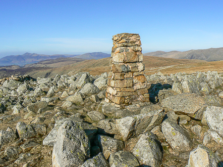
The trig point at High Raise's summit.
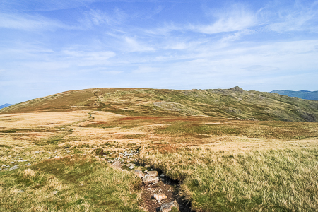
The path to High Raise from Thunacar Knott.
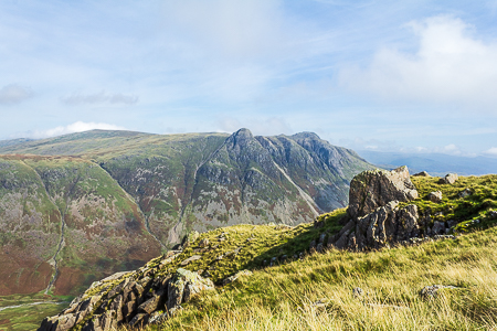
Looking across to the pointed top of High Raise from The Band.
Stickle Ghyll car park - Stickle Tarn - Sergeant Man - Thunacar Knott - Pavey Ark - Harrison Stickle - Thunacar Knott - High Raise - Sergeant Man - Blea Rigg - Silver How - Grasmere
Red Lion Hotel, Grasmere - Silver How - Lang How - Swinescar Pike - Castle How - Blea Rigg - Sergeant Man - High Raise (TP) - Low White Stones - Far Easedale - Red Lion Hotel, Grasmere
Grasmere - Easedale Tarn - Tarn Crag (142) - Codale Head (143) - Sergeant Man (144) - High Raise (145) - Low White Stones (146) - Greenup Edge - Far Easedale - Grasmere
All pictures copyright © Peak Walker 2021
©Crown copyright. All rights reserved. Licence number 100045184.